Security and response
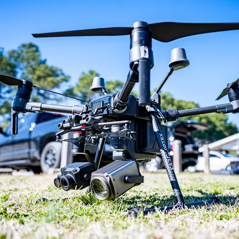
An aerial resource subordinate to the team leading the search
In an emergency, contact authorities and rescue services first. Never delay that call to complete a DataTerra form. A drone may provide imagery of assigned sectors but does not replace command, ground personnel, communications or official procedures.
Two different scopes
A real response depends on immediate availability, location, access, airspace, weather, light, terrain, link and coordination with operational command. Preparedness work can be planned in advance: mapping sectors, testing coverage, defining naming and reviewing how observations will be relayed during an exercise.
Command assigns sectors, priorities, altitude, prohibited zones and communication channel. Thermal cameras, night operations and live relay are considered only where equipment, staff, authorization and conditions support them.
How the mission is prepared
- 1
Describe the site and decision.
Location, area, environment, urgency and expected deliverables.
- 2
DataTerra checks feasibility.
Airspace, access, weather, equipment, resolution and permissions.
- 3
Receive a clear quote.
The proposal defines capture, processing, outputs, limits and conditions.
- 4
Access the results.
Agreed files and viewers are delivered through the client workspace.
Possible deliverables
- ✓photographs or video of assigned sectors;
- ✓thermal imagery where scope and equipment are confirmed;
- ✓geolocated observations relayed to designated command;
- ✓coverage map or record of searched sectors;
- ✓post-exercise or mission documentation where requested.
Example of the DataTerra mission report format (Corasol case) — shown only as a format sample, not as a demonstration of this operation.
📄 View a sample report (PDF)Limits and conditions
Detection, recognition or location of a person is not guaranteed. Vegetation, relief, water, temperature, movement, size, light, resolution and observer fatigue may hide a target. A reviewed sector is not certified empty. Rescue command determines priorities, verification and ground deployment.
Frequently asked questions
Should I contact DataTerra first?▸
No. During an emergency, contact the competent rescue services and authorities immediately.
Is finding a person guaranteed?▸
No. The drone offers an additional view under limited conditions, without a detection or location guarantee.
Can an exercise be prepared before an emergency?▸
Yes. It is the best setting for defining sectors, communications, coverage and limitations with responsible teams.
A mission-specific quote
Each mission uses only the methods required by its goal. GCPs, thermal or multispectral cameras, 3D models and reports are included when relevant and confirmed in the quote. RTK is mentioned only when its availability is confirmed explicitly. Submitting the request does not trigger a charge; DataTerra replies with a proposal.
Coverage and feasibility
Operations are available in Mexico and Colombia depending on location and operator availability. Airspace, site permission, access, weather, risk and required equipment are checked before confirmation.
Related operations
← Back to drone services

Tell us what you need to decide and which site must be documented.
Request a mission quote