Modelling, heritage and media
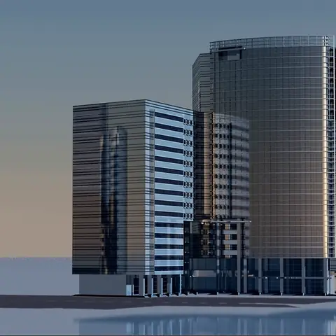
A 3D model for exploring the building's visible exterior geometry
A vertical flight mainly describes the roof. Reconstructing a building also requires oblique views, orbits and façade imagery with sufficient continuity. DataTerra designs capture around the intended use and the surfaces that can actually be observed.
Defining use before capture
The client states whether the model is for visualization, condition documentation, intervention context, communication or a technical 3D workflow. Required inputs include dimensions, available drawings, coordinate reference where relevant, formats, surroundings and useful detail. A visualization objective does not require the same acquisition as a point cloud intended for measurement or technical integration.
Building complete coverage
The mission may combine multi-height orbits, oblique roof and façade views and accessible detail images. Trees, poles, neighbouring buildings, narrow courtyards, overhangs and hidden areas are identified before processing. Review checks for gaps, motion blur and lighting changes that can weaken texture or geometry.
How the mission is prepared
- 1
Describe the site and decision.
Location, area, environment, urgency and expected deliverables.
- 2
DataTerra checks feasibility.
Airspace, access, weather, equipment, resolution and permissions.
- 3
Receive a clear quote.
The proposal defines capture, processing, outputs, limits and conditions.
- 4
Access the results.
Agreed files and viewers are delivered through the client workspace.
Possible deliverables
- ✓textured 3D mesh;
- ✓point cloud and surface model;
- ✓selected source photographs;
- ✓agreed 3D file format;
- ✓interactive web viewing where included;
- ✓report describing method, coverage and incomplete areas.
DataTerra OS has verified 3D processing and viewing capability. Final format and detail depend on capture and are confirmed in the quote; every derivative is not included automatically.
Example of the DataTerra mission report format (Corasol case) — shown only as a format sample, not as a demonstration of this operation.
📄 View a sample report (PDF)Limits and conditions
Glass, water, reflective metal, uniform surfaces, thin elements and occlusions can create noise or gaps. The model represents exterior geometry captured on a given date. It is not automatically BIM, a certified as-built model, a signed architectural survey or an interior survey.
Frequently asked questions
Can the model be viewed in a browser?▸
Interactive web viewing may be included when the delivery scope and format support it.
Do you deliver BIM files?▸
BIM is not claimed. Agreed 3D geometry may be delivered, while semantic BIM modelling and certification require a separate specialist scope.
Are interiors and hidden areas reconstructed?▸
Not from exterior aerial capture. Only surfaces observed with sufficient coverage can be represented.
A mission-specific quote
Each mission uses only the methods required by its goal. GCPs, thermal or multispectral cameras, 3D models and reports are included when relevant and confirmed in the quote. RTK is mentioned only when its availability is confirmed explicitly. Submitting the request does not trigger a charge; DataTerra replies with a proposal.
Coverage and feasibility
Operations are available in Mexico and Colombia depending on location and operator availability. Airspace, site permission, access, weather, risk and required equipment are checked before confirmation.
Related operations
← Back to drone services
Tell us what you need to decide and which site must be documented.
Request a mission quote