Modelling, heritage and media
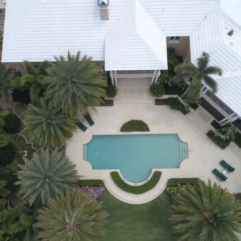
Aerial imagery that places the property in its real surroundings
Real-estate aerial photography is not an unscripted flight around a building. Capture should show scale, relationships between buildings and outdoor areas, access and context without distorting or hiding important property characteristics.
Preparing the commercial brief
The intended use is defined first: sale or rental listing, project presentation, hotel, development, land or corporate archive. The client identifies priority messages, property limits, areas that must not appear, orientation, preferred time and vertical or horizontal formats for each platform.
A shot list covers overviews, access, façades, outdoor spaces and landscape context. Occupancy, neighbours, vehicles, people, privacy, owner authorization, airspace and light affect timing and route.
How the mission is prepared
- 1
Describe the site and decision.
Location, area, environment, urgency and expected deliverables.
- 2
DataTerra checks feasibility.
Airspace, access, weather, equipment, resolution and permissions.
- 3
Receive a clear quote.
The proposal defines capture, processing, outputs, limits and conditions.
- 4
Access the results.
Agreed files and viewers are delivered through the client workspace.
Possible deliverables
- ✓selected photographs edited within the agreed scope;
- ✓stabilized video sequences;
- ✓horizontal and vertical versions for agreed channels;
- ✓raw footage only when specifically requested;
- ✓web-optimized and high-resolution files;
- ✓editing, grading, titles, music or captions only when quoted.
Scriptwriting, talent, voice-over, music licensing, interior photography, staging and an advertising campaign are not included automatically.
Example of the DataTerra mission report format (Corasol case) — shown only as a format sample, not as a demonstration of this operation.
📄 View a sample report (PDF)Limits and conditions
Editing may correct exposure, colour and framing but must not remove elements that change how the property is understood. The client confirms property, image, trademark and commercial usage permissions. DataTerra does not guarantee sales, bookings or listing performance.
Frequently asked questions
Is interior photography included?▸
Not unless explicitly added; this page covers aerial and exterior capture.
Are raw files delivered?▸
Only when agreed in the quote, including format and usage terms.
Can neighbouring buildings or site features be removed?▸
Not where removal would make the property representation misleading. Acceptable editing is agreed before delivery.
A mission-specific quote
Each mission uses only the methods required by its goal. GCPs, thermal or multispectral cameras, 3D models and reports are included when relevant and confirmed in the quote. RTK is mentioned only when its availability is confirmed explicitly. Submitting the request does not trigger a charge; DataTerra replies with a proposal.
Coverage and feasibility
Operations are available in Mexico and Colombia depending on location and operator availability. Airspace, site permission, access, weather, risk and required equipment are checked before confirmation.
Related operations
← Back to drone services
Tell us what you need to decide and which site must be documented.
Request a mission quote