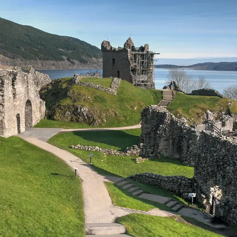
Modelling, heritage and media
A visual and geometric baseline for heritage
Aerial capture can document the visible form of a monument, ruin or archaeological landscape without direct contact. Its value is not only an attractive model: date, coverage, method and unseen areas must be preserved so the record can support study, conservation or communication.
Planning a sensitive mission
The owner and specialist define the objective, priority elements, fragility, exclusion zones, authorized movement and useful detail. Planning considers vegetation, terrain, visitors, wildlife, unstable structures and heritage restrictions. Permission is required from the owner and, where applicable, the competent authority.
Capture may combine general mapping, orbits, façades and visible details. For later comparison, the boundary, parameters, controls and naming should be retained. Nothing is moved, cleaned or touched simply to improve the image.
How the mission is prepared
- 1
Describe the site and decision.
Location, area, environment, urgency and expected deliverables.
- 2
DataTerra checks feasibility.
Airspace, access, weather, equipment, resolution and permissions.
- 3
Receive a clear quote.
The proposal defines capture, processing, outputs, limits and conditions.
- 4
Access the results.
Agreed files and viewers are delivered through the client workspace.
Possible deliverables
- ✓orthophoto and cartographic context;
- ✓located overview and detail photographs;
- ✓point cloud, surface model or microtopography;
- ✓mesh or interactive 3D viewing where coverage is sufficient;
- ✓agreed geospatial files;
- ✓report documenting method, date, coverage and limitations.
Example of the DataTerra mission report format (Corasol case) — shown only as a format sample, not as a demonstration of this operation.
📄 View a sample report (PDF)Limits and conditions
Vegetation, shadows, collapse, closed areas and uniform surfaces may hide parts of the site. DataTerra documents visible geometry and condition; it does not automatically perform archaeological interpretation, dating, authentication, excavation or conservation diagnosis. Those conclusions remain with archaeologists, architects, conservators and authorities.
Frequently asked questions
Is authorization required?▸
Yes, from the owner and, where applicable, the relevant heritage, archaeological or aviation authority.
Can the model date or interpret the site?▸
Not by itself. It supplies a record for specialists to analyse with other sources and field work.
Can documentation be repeated after restoration?▸
Yes, with a comparable protocol; changes in light, vegetation and access must be documented.
A mission-specific quote
Each mission uses only the methods required by its goal. GCPs, thermal or multispectral cameras, 3D models and reports are included when relevant and confirmed in the quote. RTK is mentioned only when its availability is confirmed explicitly. Submitting the request does not trigger a charge; DataTerra replies with a proposal.
Coverage and feasibility
Operations are available in Mexico and Colombia depending on location and operator availability. Airspace, site permission, access, weather, risk and required equipment are checked before confirmation.
Related operations
← Back to drone services
Tell us what you need to decide and which site must be documented.
Request a mission quote