Mapping and measurement
Drone topography for documenting terrain and preparing technical work
A topographic survey is not defined simply by flying low or collecting many images. It must start from the intended use, a known coordinate reference, a target accuracy and controls that allow the result to be assessed. The drone provides dense coverage; the control method and professional responsibility determine how the data may be used.
What must be defined before flight
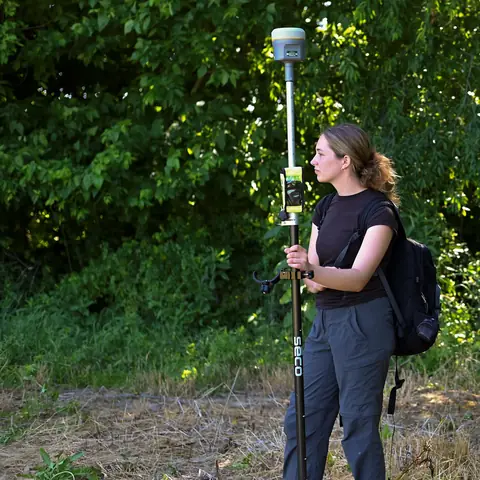
The quote requires the boundary, area, relief, vegetation, features to be represented, technical-team formats and required tolerance. Existing control points, reference plans and safe locations for GCPs or checkpoints must also be identified. RTK availability must be confirmed explicitly in the quote.
The GCP workflow is operational. RTK and GCPs are not interchangeable marketing labels: the method depends on the site, accuracy requirement, equipment actually available and ability to observe or survey controls. Any required methodology or licensed sign-off must be stated before acquisition.
Acquisition and checks
Altitude, overlap and camera orientation are adapted to relief and required detail. Review after flight covers image quality, coverage, adjustment consistency and available control results. Dense vegetation, water, uniform surfaces, thin structures and hidden areas can limit reconstruction.
How the mission is prepared
- 1
Describe the site and decision.
Location, area, environment, urgency and expected deliverables.
- 2
DataTerra checks feasibility.
Airspace, access, weather, equipment, resolution and permissions.
- 3
Receive a clear quote.
The proposal defines capture, processing, outputs, limits and conditions.
- 4
Access the results.
Agreed files and viewers are delivered through the client workspace.
Possible deliverables
- ✓georeferenced orthophoto and point cloud;
- ✓digital surface model and, where ground can be separated from objects, a terrain model;
- ✓agreed contours, profiles, sections or surfaces;
- ✓files in the requested coordinate reference system;
- ✓a method and control report, with accuracy stated only when supported.
The public Corasol example shows how DataTerra documents GSD, coordinate reference, orthophoto, elevation and contours. It is not presented as a signed topographic plan or as a performance guarantee for another site.
Example of the DataTerra mission report format (Corasol case) — shown only as a format sample, not as a demonstration of this operation.
📄 View a sample report (PDF)Limits and conditions
Drone photogrammetry can support a surveyor and reduce field work, but it does not replace property boundaries, legal demarcation, certification or documents requiring a licensed professional's signature. The scope must define who validates, signs or integrates outputs into the engineering project.
Frequently asked questions
How do you choose between GCPs and RTK?▸
The GCP workflow is operational. RTK is included only when its availability is confirmed explicitly; the method depends on accuracy, site conditions and the ability to establish controls.
Are a DSM and DTM the same output?▸
No. A DSM represents visible surfaces including objects and vegetation. A DTM attempts to represent bare terrain and depends on whether the data supports separating those elements.
Does the output replace a signed survey?▸
Not where regulations or the intended use require a licensed surveyor or other qualified professional to validate and sign it.
A mission-specific quote
Each mission uses only the methods required by its goal. GCPs, thermal or multispectral cameras, 3D models and reports are included when relevant and confirmed in the quote. RTK is mentioned only when its availability is confirmed explicitly. Submitting the request does not trigger a charge; DataTerra replies with a proposal.
Coverage and feasibility
Operations are available in Mexico and Colombia depending on location and operator availability. Airspace, site permission, access, weather, risk and required equipment are checked before confirmation.
Related operations
← Back to drone services
Tell us what you need to decide and which site must be documented.
Request a mission quote