Technology & accuracy
Technology selected after the decision and required confidence level
RTK, GCPs, thermal and multispectral are not equivalent outcomes or upgrades for every mission. Each answers a different question. The quote should state intended use, target accuracy, controls and conditions that may limit the result.
Standard GPS, GCPs and RTK
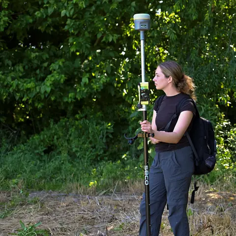
Standard GPS may suit visual documentation or general context; current product truth places typical absolute accuracy around 1–3 m, not centimetres. GCPs are visible targets with ground-measured coordinates. Suitable distribution, traceable measurement and independent checkpoints can adjust and assess the model. DataTerra's GCP workflow is operational.
RTK corrects positioning during acquisition where compatible aircraft, link and correction source are available. DataTerra OS displays RTK bases during preparation, while RTK equipment availability for a mission is confirmed in the quote. RTK does not automatically remove the need for independent checks.
What centimetre accuracy means
It is not a promise across every surface or mission. Sensor, altitude, overlap, texture, terrain, vegetation, geometry, coordinate system, GCP/RTK and validation determine the achievable level. Any accuracy statement must say whether it is absolute or relative, how it was checked and which output it concerns.
Relative volume comparison
DataTerra OS can vertically co-register two flights processed in DataTerra without RTK for volume comparison. This is relative accuracy between campaigns, not absolute accuracy. It requires stable surrounding areas and sufficient checks and does not replace RTK/GCP.
Thermal and multispectral
Thermal sensors record apparent temperature affected by emissivity, reflection, weather, angle and operating state. Multispectral sensors record bands for indices such as NDVI or NDRE, affected by calibration, light, crop and context. Compatible equipment and conditions are confirmed per mission. Neither automatically diagnoses cause or action.
What is documented
The proposal identifies the method, confirmed sensor, coordinate reference, target resolution or accuracy, deliverables, checks and limitations. Final reporting should explain what was done without turning a target into a universal guarantee.
How the mission is prepared
- 1
Describe the site and decision.
Location, area, environment, urgency and expected deliverables.
- 2
DataTerra checks feasibility.
Airspace, access, weather, equipment, resolution and permissions.
- 3
Receive a clear quote.
The proposal defines capture, processing, outputs, limits and conditions.
- 4
Access the results.
Agreed files and viewers are delivered through the client workspace.
Example of the DataTerra mission report format (Corasol case) — shown only as a format sample, not as a demonstration of this operation.
📄 View a sample report (PDF)Frequently asked questions
Does RTK guarantee centimetres everywhere?▸
No. It improves positioning, while capture, signal, geometry, processing and validation still determine the result.
Are GCPs and RTK always required together?▸
No. Control is designed around use, accuracy and site; methods may be combined or used differently.
Is volume comparison without RTK absolute accuracy?▸
No. It is relative between two DataTerra flights under stability conditions and does not replace absolute control.
A mission-specific quote
Each mission uses only the methods required by its goal. GCPs, thermal or multispectral cameras, 3D models and reports are included when relevant and confirmed in the quote. RTK is mentioned only when its availability is confirmed explicitly. Submitting the request does not trigger a charge; DataTerra replies with a proposal.
Coverage and feasibility
Operations are available in Mexico and Colombia depending on location and operator availability. Airspace, site permission, access, weather, risk and required equipment are checked before confirmation.
Related operations
← Back to drone services
Tell us what you need to decide and which site must be documented.
Request a mission quote