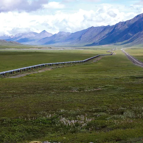
Infrastructure inspection
A corridor documented by segment to focus ground verification
A drone can associate imagery and observations with chainage, but a long corridor must be segmented according to access, endurance, terrain, airspace and visual link. The objective is to guide field review, not declare pipeline integrity.
Planning the campaign
The client supplies alignment, chainage, right-of-way width, access, above-ground facilities and priority points. The parties define visible signs of interest, naming, frequency and the procedure for escalating observations. BVLOS is not assumed and requires the applicable regulatory framework and approvals.
Possible observations and deliverables
The mission may document visible encroachment, land-use change, vegetation, erosion, runoff, access, recent works or exterior condition of surface facilities. Outputs may include geolocated photos and video, orthophotos of selected areas, observation maps, chainage inventories and an illustrated report.
A stain, vegetation change or disturbed ground is a visible sign requiring verification; it is not automatic leak detection or confirmation.
How the mission is prepared
- 1
Describe the site and decision.
Location, area, environment, urgency and expected deliverables.
- 2
DataTerra checks feasibility.
Airspace, access, weather, equipment, resolution and permissions.
- 3
Receive a clear quote.
The proposal defines capture, processing, outputs, limits and conditions.
- 4
Access the results.
Agreed files and viewers are delivered through the client workspace.
Example of the DataTerra mission report format (Corasol case) — shown only as a format sample, not as a demonstration of this operation.
📄 View a sample report (PDF)Limits and conditions
The mission does not prove tightness, pressure, internal corrosion, thickness or mechanical integrity. It does not replace sensors, required patrols, instrumented inspection or emergency response. The asset operator determines criticality, field checks and action.
Frequently asked questions
Does the drone detect leaks?▸
Automatic detection is not claimed. It documents visible signs that the operator must verify with appropriate methods.
Can the whole corridor be covered in one flight?▸
Not necessarily. It is segmented by endurance, access, terrain, visibility, airspace and safety.
Is BVLOS included?▸
Not by default. Operations beyond visual line of sight require a specific assessment, authorization and operating organization.
A mission-specific quote
Each mission uses only the methods required by its goal. GCPs, thermal or multispectral cameras, 3D models and reports are included when relevant and confirmed in the quote. RTK is mentioned only when its availability is confirmed explicitly. Submitting the request does not trigger a charge; DataTerra replies with a proposal.
Coverage and feasibility
Operations are available in Mexico and Colombia depending on location and operator availability. Airspace, site permission, access, weather, risk and required equipment are checked before confirmation.
Related operations
← Back to drone services
Tell us what you need to decide and which site must be documented.
Request a mission quote