Infrastructure inspection
A visual inventory by tower and segment to guide maintenance
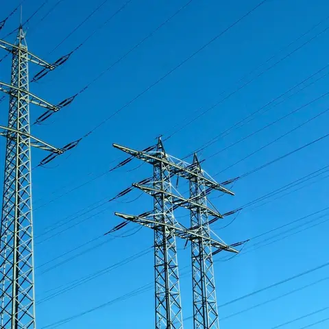
A power line is not inspected as a single point. The corridor is divided by towers, spans or chainage so every image can be located and compared with the operator's inventory. The mission always starts from the network safety procedure.
Operational planning
The operator provides alignment, structure identifiers, energization status, safe distances and priority components. Planning covers access, terrain, crossings, vegetation, obstacles, electromagnetic environment and airspace. Flight close to energized conductors and BVLOS operations are never assumed.
Visible elements and deliverables
Capture may document exterior tower structure, insulators, visible conductors, fittings, signage, vegetation and right-of-way context. Outputs may include photos and video by tower or segment, an observation map, indexed inventory and illustrated report. Thermal work requires equipment, distance and conditions confirmed in the quote.
Imagery may flag a missing item, apparent damage, nearby vegetation or visible change. It does not automatically measure electrical performance, discharge, reliable temperature, mechanical tension or criticality.
How the mission is prepared
- 1
Describe the site and decision.
Location, area, environment, urgency and expected deliverables.
- 2
DataTerra checks feasibility.
Airspace, access, weather, equipment, resolution and permissions.
- 3
Receive a clear quote.
The proposal defines capture, processing, outputs, limits and conditions.
- 4
Access the results.
Agreed files and viewers are delivered through the client workspace.
Example of the DataTerra mission report format (Corasol case) — shown only as a format sample, not as a demonstration of this operation.
📄 View a sample report (PDF)Limits and conditions
DataTerra documents visible conditions from an approved operating distance. Network specialists interpret, prioritize and decide isolation, access and repairs. Aerial imagery does not replace electrical tests or contact inspection.
Frequently asked questions
Do you fly close to energized lines?▸
Only after a specific assessment and under distances and coordination accepted by the operator; this is never assumed.
Is thermal imaging included?▸
No. Equipment, distance, load and acquisition conditions must be confirmed separately.
Can long corridors be covered?▸
They are segmented according to access, endurance, visibility, regulation and coordination. BVLOS is not included by default.
A mission-specific quote
Each mission uses only the methods required by its goal. GCPs, thermal or multispectral cameras, 3D models and reports are included when relevant and confirmed in the quote. RTK is mentioned only when its availability is confirmed explicitly. Submitting the request does not trigger a charge; DataTerra replies with a proposal.
Coverage and feasibility
Operations are available in Mexico and Colombia depending on location and operator availability. Airspace, site permission, access, weather, risk and required equipment are checked before confirmation.
Related operations
← Back to drone services
Tell us what you need to decide and which site must be documented.
Request a mission quote