Infrastructure inspection
Located documentation for deciding where technical inspection should move closer
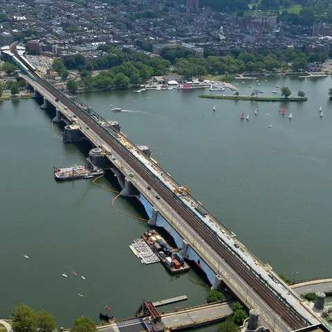
A drone can reduce initial exposure above water, traffic or elevated areas, but useful inspection starts by dividing the asset into components. The technical team defines which faces, supports or joints must be viewed and how observations will be named.
Planning visual access
The client provides drawings or naming conventions, known history, priority areas and the campaign objective. Planning considers traffic, navigation, water, cables, vegetation, GNSS conditions, underside surfaces and safe distances. An area the drone cannot view is marked unobserved, never compliant by default.
Elements that may be documented
- ›visible deck, pier, abutment, bearing and joint faces;
- ›barriers, drainage, edges and exterior elements;
- ›apparent cracking, corrosion, visible material loss or deformation;
- ›visible runoff, vegetation or spalling areas;
- ›overall context for prioritizing close access.
Imagery alone does not measure crack depth, thickness, internal corrosion, residual capacity or stability.
How the mission is prepared
- 1
Describe the site and decision.
Location, area, environment, urgency and expected deliverables.
- 2
DataTerra checks feasibility.
Airspace, access, weather, equipment, resolution and permissions.
- 3
Receive a clear quote.
The proposal defines capture, processing, outputs, limits and conditions.
- 4
Access the results.
Agreed files and viewers are delivered through the client workspace.
Possible deliverables
- ✓photographs and video indexed by component;
- ✓plan or table locating observations;
- ✓comparable views where a repeatable protocol is used;
- ✓partial 3D model where geometry and coverage support it;
- ✓illustrated report listing observations, unseen areas and follow-up checks.
Example of the DataTerra mission report format (Corasol case) — shown only as a format sample, not as a demonstration of this operation.
📄 View a sample report (PDF)Limits and conditions
DataTerra delivers organized visual evidence. The responsible engineer determines criticality, testing, physical access, traffic closure and repairs. The mission does not certify asset safety or replace contact inspection and instrumentation.
Frequently asked questions
Can the deck underside be inspected?▸
It depends on access, geometry, signal, water, traffic and safe distance. Areas that cannot be observed are identified.
Can the drone measure crack depth?▸
Not from ordinary imagery. It can locate a visible sign so the engineer can specify the appropriate test.
Can the same views be repeated?▸
Yes, when an agreed naming and capture protocol is used, subject to conditions during each campaign.
A mission-specific quote
Each mission uses only the methods required by its goal. GCPs, thermal or multispectral cameras, 3D models and reports are included when relevant and confirmed in the quote. RTK is mentioned only when its availability is confirmed explicitly. Submitting the request does not trigger a charge; DataTerra replies with a proposal.
Coverage and feasibility
Operations are available in Mexico and Colombia depending on location and operator availability. Airspace, site permission, access, weather, risk and required equipment are checked before confirmation.
Related operations
← Back to drone services
Tell us what you need to decide and which site must be documented.
Request a mission quote