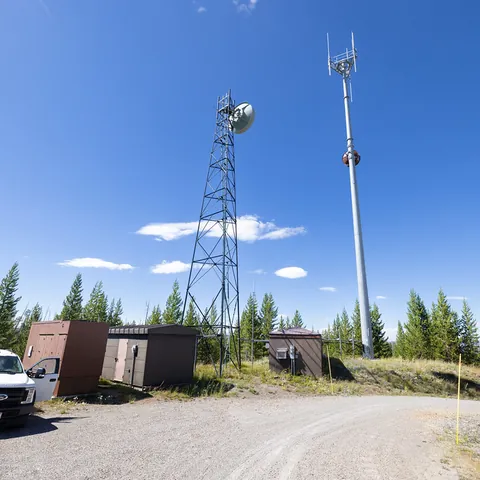
Infrastructure inspection
Visual coverage organized by tower face, level and equipment
A generic orbit is not enough to review a tower. Each image must relate to the structure, level or equipment observed while maintaining distances compatible with safety, image quality and the radio-frequency environment.
Planning with the site representative
Before flight, the client provides tower type and approximate height, available drawings or inventory, priority equipment, face orientation, exclusion zone, operating status and access rules. The site representative identifies emissions, cables, nearby lines, active antennas and applicable safety procedures.
Capture may combine multi-level orbits, overview images and controlled close views. Wind, cable movement, backlighting, obstacles, GNSS conditions and RF environment may require the distance or route to change.
What may be documented
- ›structural faces and levels;
- ›visible antennas, mounts, fasteners, cables and exterior equipment;
- ›apparent corrosion, deformation, missing items or visually unusual connections;
- ›immediate surroundings, access and relevant obstacles;
- ›points defined by the client's inspection protocol.
Imagery may flag a visible condition but does not test torque, electrical continuity, RF performance, material thickness, strength or structural stability.
How the mission is prepared
- 1
Describe the site and decision.
Location, area, environment, urgency and expected deliverables.
- 2
DataTerra checks feasibility.
Airspace, access, weather, equipment, resolution and permissions.
- 3
Receive a clear quote.
The proposal defines capture, processing, outputs, limits and conditions.
- 4
Access the results.
Agreed files and viewers are delivered through the client workspace.
Possible deliverables
- ✓photo inventory indexed by face, level or component;
- ✓overview and detail images tied to agreed naming;
- ✓plan or table locating observations;
- ✓exterior 3D model where geometry, visibility and capture support it;
- ✓illustrated report for maintenance planning or close-up review.
Example of the DataTerra mission report format (Corasol case) — shown only as a format sample, not as a demonstration of this operation.
📄 View a sample report (PDF)Limits and conditions
Feasibility depends on airspace, wind, access, lines, emissions and coordination with the operator. DataTerra documents visible exterior condition. Structural, RF, electrical and maintenance professionals validate interpretation, criticality and action.
Frequently asked questions
Does the mission eliminate climbing?▸
It may reduce initial climbing and identify where intervention is needed, while physical verification or repair may still require access.
Can imagery confirm that an antenna works?▸
No. RF and electrical performance require appropriate measurements and specialists.
Is a 3D model always delivered?▸
No. It is included only where geometry, visibility, distance and coverage can support a useful model.
A mission-specific quote
Each mission uses only the methods required by its goal. GCPs, thermal or multispectral cameras, 3D models and reports are included when relevant and confirmed in the quote. RTK is mentioned only when its availability is confirmed explicitly. Submitting the request does not trigger a charge; DataTerra replies with a proposal.
Coverage and feasibility
Operations are available in Mexico and Colombia depending on location and operator availability. Airspace, site permission, access, weather, risk and required equipment are checked before confirmation.
Related operations
← Back to drone services
Tell us what you need to decide and which site must be documented.
Request a mission quote