Infrastructure inspection
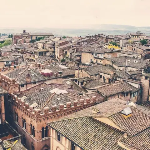
A located visual record of roofs and façades
An aerial inspection is useful when each image can be related to a face, area or building component. DataTerra plans capture around geometry, points of interest and the way the responsible technical professional will review the result.
Preparing the mission
The client provides the building, available plans, known history and objective: general review, maintenance preparation, post-event documentation or follow-up of a specific zone. Obstacles, cables, courtyards, fragile surfaces, occupied areas and over-people restrictions are identified before flight.
Capture may combine nadir roof views, oblique images of slopes and joints, and façade sequences. It cannot promise visibility below tiles, membranes, equipment or overhangs.
Visible elements that may be documented
- ›displaced, broken or missing elements;
- ›apparent cracking, corrosion, deformation or material loss;
- ›gutters, downpipes, joints, seals and transitions;
- ›visible standing water, debris or vegetation;
- ›exterior condition of rooftop equipment and penetrations.
These are visual observations. They do not establish cause, severity, internal moisture, water-tightness or structural capacity.
How the mission is prepared
- 1
Describe the site and decision.
Location, area, environment, urgency and expected deliverables.
- 2
DataTerra checks feasibility.
Airspace, access, weather, equipment, resolution and permissions.
- 3
Receive a clear quote.
The proposal defines capture, processing, outputs, limits and conditions.
- 4
Access the results.
Agreed files and viewers are delivered through the client workspace.
Possible deliverables
- ✓high-resolution photographs organized by face and area;
- ✓plan or sketch locating observations;
- ✓roof orthophoto where geometry supports it;
- ✓exterior 3D model where capture is sufficient;
- ✓illustrated report separating observations, unseen areas and recommended follow-up.
Thermal imaging is a separate scope requiring suitable equipment, compatible thermal conditions and explicit confirmation in the quote. It is never implied by an RGB mission.
Example of the DataTerra mission report format (Corasol case) — shown only as a format sample, not as a demonstration of this operation.
📄 View a sample report (PDF)Limits and conditions
A drone can reduce initial access to certain areas, but cannot eliminate every close-up visit, scaffold or intervention. DataTerra organizes the visual evidence; architects, engineers, roofers, electricians or other specialists determine diagnosis and repair.
Frequently asked questions
Can the drone detect leaks inside the building?▸
No. Exterior imagery may show visible signs, while a leak and its cause require additional investigation.
Is thermal imaging included?▸
Only when quoted with suitable equipment and conditions. An RGB camera does not produce thermal diagnosis.
Can scaffolding always be avoided?▸
The drone can reduce initial access for documentation and prioritization, but specialists may still need close access, testing or repairs.
A mission-specific quote
Each mission uses only the methods required by its goal. GCPs, thermal or multispectral cameras, 3D models and reports are included when relevant and confirmed in the quote. RTK is mentioned only when its availability is confirmed explicitly. Submitting the request does not trigger a charge; DataTerra replies with a proposal.
Coverage and feasibility
Operations are available in Mexico and Colombia depending on location and operator availability. Airspace, site permission, access, weather, risk and required equipment are checked before confirmation.
Related operations
← Back to drone services
Tell us what you need to decide and which site must be documented.
Request a mission quote