Mapping and measurement
Volume measurements with an explained base and repeatable site surveys
A volume value does not depend on the 3D surface alone. It also depends on the measurement footprint and selected reference surface. DataTerra keeps those parameters with the result so the client can understand what was measured and repeat the method on a later visit.
What the mission can monitor
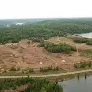
The assignment may document stockpiles, excavation, fill or the general condition of a work area. The quote distinguishes a one-off measurement, an inventory of several piles and a recurring series. Required inputs include the boundary, frequency, reporting date and any design surface, natural-ground survey or previous reference available.
Footprint and reference surface
A stockpile base may use a best-fit perimeter, minimum elevation or agreed fixed elevation. Cut-and-fill work may require comparison with natural ground, a design surface or another measured state. Changing the base or boundary changes the number, so both must remain visible.
Flight design seeks complete coverage of edges, slopes and high points. Review checks for gaps, vegetation, machinery, moving material and other objects that could affect the surface.
Comparing two surveys
The same footprint and rules can be reused for improved comparability. DataTerra OS also supports relative co-registration between two DataTerra-processed flights when stable surrounding areas are available. It is not absolute accuracy, does not replace RTK/GCP and is blocked when stability checks are insufficient.
How the mission is prepared
- 1
Describe the site and decision.
Location, area, environment, urgency and expected deliverables.
- 2
DataTerra checks feasibility.
Airspace, access, weather, equipment, resolution and permissions.
- 3
Receive a clear quote.
The proposal defines capture, processing, outputs, limits and conditions.
- 4
Access the results.
Agreed files and viewers are delivered through the client workspace.
Possible deliverables
- ✓orthophoto and surface model for the observed date;
- ✓documented footprint and base for each measurement;
- ✓cut, fill and net values where applicable;
- ✓difference map or calculated-surface view;
- ✓agreed geospatial files and PDF report;
- ✓monitoring table where several dates are included.
Volume is not automatically converted to mass or tonnes. That requires a reliable material density agreed separately from the geometric calculation.
Example of the DataTerra mission report format (Corasol case) — shown only as a format sample, not as a demonstration of this operation.
📄 View a sample report (PDF)Limits and conditions
Accuracy depends on scale, georeferencing, surface visibility, pile geometry, edge definition and the reference chosen. Rain, vegetation, dust, moving equipment or hidden faces may require acquisition to be repeated or qualified. The report must distinguish observations, assumptions and calculated values.
Frequently asked questions
Which base is used for a stockpile?▸
It depends on geometry and available information: a best-fit perimeter, minimum elevation, fixed elevation or another agreed surface.
Can two dates be compared without RTK?▸
A relative comparison is available under strict conditions: both flights processed in DataTerra and sufficient stable surrounding areas. It is not absolute accuracy and does not replace RTK/GCP.
Does the report provide tonnes?▸
Not automatically. The drone provides geometry and volume; conversion to mass requires representative density supplied or validated separately.
A mission-specific quote
Each mission uses only the methods required by its goal. GCPs, thermal or multispectral cameras, 3D models and reports are included when relevant and confirmed in the quote. RTK is mentioned only when its availability is confirmed explicitly. Submitting the request does not trigger a charge; DataTerra replies with a proposal.
Coverage and feasibility
Operations are available in Mexico and Colombia depending on location and operator availability. Airspace, site permission, access, weather, risk and required equipment are checked before confirmation.
Related operations
← Back to drone services
Tell us what you need to decide and which site must be documented.
Request a mission quote